

- cross-posted to:
- [email protected]
- [email protected]
- cross-posted to:
- [email protected]
- [email protected]
You must log in or # to comment.
All of you are invited on [email protected]
Also checkout the many editing tools, such as https://mapcomplete.org, https://streetcomplete.app,…
I successfully used Every Door during my holidays to contribute
There’s a small learning curve I wish some bothered to understand first. Does this app help? The part of this I don’t like is vacationers leaving useless names like ‘Mango lady’, ‘many street vendors’ for a block, or ‘local restaurant’ since they can’t read the sign as opposed marking up the cuisine type, maybe adding an English description, & leaving the name blank. Nobody expects uploads to be perfect but Bangkok is littered with this noise that makes it hard to follow or find things.
It takes effort and knowledge to make good contributions, this app is just a tool to do that.
I can only say I myself try to make valuable contributions, some other people might care less.
I think EveryDoor requires some relatively deep understanding of OSM before actually being a useful tool. So edits like this should be rare with that tool. Many of the edits like this are from when MapsMe was very popular and suddenly introduced editing, without enough nuance in the process. Bad edits do happen everywhere, you need a good balance between people who data curation and newbies making beginner mistakes. In some places, there’s a lack of experienced people maintaining the data.
Every Door
thank you for sharing, definitely the easiest for Android from my research :-)
Note: there is a comparison of editor apps here: https://wiki.openstreetmap.org/wiki/Comparison_of_editorsdeleted by creator
Thank you for sharing the links!
the biggest problem I have with switching is that Google Maps is a business directory. open street maps is empty where i live. it works okay for navigation, but not so much for finding a coffee.
there are ways to make it easier; it’s been gamified:
https://github.com/streetcomplete/StreetComplete
Available on FDROID.
When my partner stops to play pokemon go, I complete some Open Street Map info quests…
Street Complete is a great app for quests regarding existing features, but also consider the feature might not exist at all yet in OSM.
Map Complete is great for adding new features. It also asks a bunch of optional simple questions about the feature which gets converted into the relevant OSM tags. It’s browser based but you can just add a shortcut to your home screen to have it quickly accessible.
@controlphreak @snrkl
Now that StreetComplete has overlay layers for places and things you can add most of the thing you’d want to add in person.I didn’t know about map complete, thanks!
I’ve just installed this now, thanks for the tip!
So many quests right on my street!
Be the change your want to see in the world https://droidify.eu.org/app/?id=de.westnordost.streetcomplete&repo_address=https://f-droid.org/archive
It says “page not found”, maybe because I’m not in EU.
I’m in the US, also says page not found for me.
Yea looks like they were linking to this: Street Complete
Very strange. It doesn’t work. I shared directly from the f-droid client droid-ify
https://f-droid.org/en/packages/de.westnordost.streetcomplete/index.html
Same in EU
Link to fdroid next time
Oh weird. That’s shared from droid-ify which is an f-droid client.
Here’s the proper link https://f-droid.org/en/packages/de.westnordost.streetcomplete/index.html
As many have already told you, you can contribute to OSM, I have put in it almost all the establishments in my area (Not at Big area but…). Although soon I have to update them
im on board with the idea in general, but im not going to do this. it would be an endless effort to the benefit of almost nobody. places go up and down so fast here that google maps is often out of date too. it’s filled with stale information and im flagging missing places constantly. every digital community in this country is a garbage pile.
the ride share apps here do use open street maps though, and im making corrections to building addresses when i find something isn’t right. it’s great.
Umm…it benefits loads of people.
On OSM you don’t have to just flag something. You can edit it directly, so it leads to more accurate information.
But you can also just flag it if editing is not your cup of tea. Here’s a convenient, non-techy tool to add notes for others to use when editing: https://www.onosm.org/
Great point
You can contribute them!
There’s a pretty barebones editor in Organic Maps, but you can also check out Street Complete and Every door (more advanced and less user friendly, though insanely efficient)
I use Vespucci, it’s advanced but still pretty easy if you just want to do basic editing. https://vespucci.io/
P.s. how do you link to an app on fdroid?
Thanks. I wish the link could be created from the f-droid automatically. I’m too lazy to try to paste the parts together
deleted by creator
Yeah, it’s interesting to look through the edit history over the years. With StreetComplete I recently fixed ~8 stores that were many years out of date, during an hour walk.
It’s fun to find a real hole-in-the-wall that even google maps doesn’t have.
That kind of contribution seems like a lower level of effort than making changes to source code.
And there are apps that make it very very easy and fun. Check out street complete.
I keep businesses in my area up-to-date, doesn’t take much time at all.
I felt the same however Organic Maps did have many businesses. And with Street Complete I can correct any errors when I visit.
It may simply be my area, but I so recommend organic maps over Osmand for business and POI lookups
Yeah trying to find anything on any of the competing apps is basically impossible. I mean ffs OSMand literally couldn’t do address lookup!
I just recently learned this.
For OsmAnd, go to search, then the categories tab, and then hit “Online Search”.
Voila, address lookup.
I have found Organic Map’s search to be far better than OSMand. OSMand has far more features though.
You’ll need to first download the relevant section of the map downloaded to be able to search it, though.
i think openstreetmaps only works in big countries honestly
What does the size of the country have to do with it? Which good big and bad small countries are you talking about?
Most people don’t use openstreetmaps on these small countries like with low/medium population it feels like apple maps on there
Can you give an example? Because I’ve just looked at Luxembourg, Nepal, and Aruba, and they’re all littered with named buildings and landmarks. Pyongyang even has a fair bit filled in.
didnt rlly try it but might try tbh but idk since i see people here where i live use google maps
edit: tried it and it really is quite outdated my house does not show up and idk if waze is even privacy respecting
Waze is google these days. They bought it some time ago.
Ohh
Apple Maps uses OpenStreetMap data in some countries.
ohh makes sense
All it takes is you to fix this. Its even easier in a small country
oh okay
You can add the POIs and fill the gaps!
And then in the web app, you need to do this complicated hold-LMB-then-select-from-list to select something, making just browsing really difficult.
Or is there a better way of doing that? I lack a good way to just browse Openstreetmap.
openstreetmap.org is a mappers website, not a map users website. It works great for mappers, but is horrible for people who want to use the map to find their way around.
I think the openstreetmap ecosystem really needs a better website for map users.
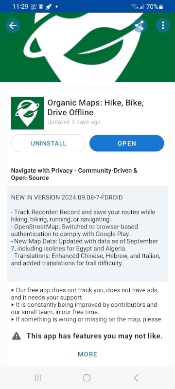
Organic Maps was put back onto the Play Store the next day day: https://organicmaps.app/news/2024-08-18/good-news-organic-maps-appeared-again-in-the-google-play-store/
Yeah but it demonstrates googles unwillingness to cooperate and give fair warnings.
You seem pretty active with OSM, so I’ll propose this here since I don’t have time to make it.
OSM is very, very popular with hikers and cyclists, and I’d argue rhey drive a lot of it’s use, especially via third-party systems. However, it’s one failing is “gravel” roads. While they support many different gravel road types, they admit on their Wiki that use of the proper terms is low.
Given the heavy use of Garmin devices, especially among gravel cyclists, mountain bikers, and bikepackers, where terrain definition is important, it would be outstanding to have an app in the Garmin store for Edge devices that could report the exact terrain type (compacted, dirt, etc) with a button mash as you ride it.
Check out StreetComplete (https://play.google.com/store/apps/details?id=de.westnordost.streetcomplete)
It does more than just road surface type, and incorporates location-based OSM editing in a very user-friendly way!
F-Droid link: StreetComplete (OpenStreetMap surveyor app) https://f-droid.org/packages/de.westnordost.streetcomplete/
Yea, I’ve used that, but it’s a phone app. Riders need a one-touch solution on Garmin (or other bike computers, but Garmin dominates the market right now).
It also doesn’t seem to let you edit anything more then a mile away from your physical location. I get that they want accuracy but it’s preventing me from editing incorrect information to a place I have just been.
You can! Browse to the location, and then click menu button > “Download data here” and the questions will appear.
I already uninstalled it so can’t confirm but I didn’t see anything to that effect at the time. I could be wrong.
That said, I got Every Door and love it. It’s got an icon right on the main screen to download whatever area you’re looking at. The UI in general is more to my liking as a geek, whereas Street Complete sorta makes a game out of it (which is awesome if that’s what you’re after).
I will add as a narrowboater.
I found towpaths also have this issue with definition of surface.
I am legally blind. (Some vision but bad)
I have a few times tried to add more ditail to areas of towpath that will help the others like me know what to expect before mooring.
Seems anything that improves this will help in your issues as well.
Not sure if you’re the one to ask, but are there any good alternatives to Strava built on OSM? I don’t need all the fitness analysis and social features, I just want to track my walk route and get basic info like miles traveled, elevation change, average speed, etc
So for the tracking and planning part, you could use OSMAnd. It’s UI is a bit confusing but it does work welll. My typical setup is:
- Plan route in OSMAnd
- Record route with a garmin
- Upload GPX to self-hosted Fittrackee or Wanderer
However you may be asking for something more like RideWithGPS.com?
OrganicMaps is amazing. Strong recommend to everyone. I only recently found out about it.
Any details on why it’s amazing? What does it do or doesn’t?
- It has the map corpus from OpenStreetMap, so one of the best in the world
- It works offline - just download the desired maps onto the device
- That makes it really, really fast. Google Maps is slower
- You can also use it in areas with bad reception. I’m using it for hiking in the woods where there is no cell phone connection available
- I really like the UI - they are f.e. better at displaying house numbers and street names than Google.
- No ads
On the hiking note, it also shows a lot of trails. I used it to navigate to a trail head and was pleasantly surprised to see a rough outline of the trails I would be using plus some others I didn’t know were there.
It even has water markers for longer trails where youd be hiking for weeks or months at a time. Sometimes those spots are dry, but you can clearly see water channels in the ground where it would be flowing.
Google’s maps are decent and can also be downloaded to be offline…? But yeah, it seems like it’s a nice alternative, especially if you want to be free from Google’s grips.
As a cyclist, organic maps never told me to go on the freaking autoroute, but google maps did…
Maybe it’s iOS specific but I had to go to a region and download the map to be able to search it, which is not great
It’s the same on Android.
It shows me where the speed cameras are :)
Waze does that too + reported police, hazards
I see no benefit to using Waze. Openstreepmap works better.
Well i didn’t know it existed so I would have had a hard time using it in the past, I just commented from my perspective that’s not an advantage over what I already use
Waze isn’t FOSS.
Same, I have recently installed LineageOS on my phone and was looking for various replacements for Goggle apps. What I really like about OrganicMaps is that it downloads the maps locally, so you can view it even if you aren’t connected to the internet.
google maps can do that too though
IIRC At one point Google Maps would let you download a map for browsing, but you couldn’t do offline navigation. Don’t know if that’s still the case.
Organic Maps does the routing on the device.
it’s had offline navigation for years now
Thanks, I wasn’t aware of that. I should have really had this information a year ago when I was constantly screenshotting Google Maps, LOL.
The feature looks made ugly on purpose though (compared to organic maps where you can just download the whole country or select more precisely what you want)
Openstreetmaps has 8.75% of the contributors Google Maps has.
Organic Maps has 1% the user base Google Maps has.
The same can be said about Lemmy and Reddit, but look where we are.
We need to support open-source projects and stop being simps for bad companies like Google.
The difficulty is asking people to get started with this. People want to get to work/navigate as quickly as possible to where they need to be, they don’t want to be figuring it out. Social media can be janky and you’ll be patient, but if you’re late for something because you’re struggling to adjust to an app you’re more likely to go back to Google/Apple Maps
Agreed! I got one for that too:
Lemmy vs Reddit
Monthly Users (0.004%) 44k vs 1.2b
1 billion users on reddit is not realistic
With 700 million bots conducting marketing and psychological warfare ops it is!
I mean in visitors.
And its still better :)
So we work harder
I just did 30 minutes of contributing to the osm database.

So? Every platform starts at 0%.
Its good to know how you measure up against the big corpos.
I think the point is 8× more contributions
This is very ironic coming from someone using Lemmy.
Im confused.
Lemmy is getting most of its contributions from people that migrated from Reddit. Reddit had (and has) tons of more content people still came here looking for a better alternative.
Hopefully you can now see the similarity.
I see the similarity, what do you mean by irony though?
I was pointing out that though the numbers are small (your point) OP was saying Organic maps had 8x contributors, so Im just confused how thats ironic… when the point is that open source users contribute more than non-open source users?
internet explorer, yahoo mail, myspace, icq… things change. unfortunately it’s mostly due to a huge company having the resources to promote their product to convince people to migrate but still. people can leave old giants.
Yeah, and Wikipedia, linux,… have become important as well, without big corpo
Proton is 5.5% the size of G-mail. 100m vs 1.8b.
i think proton is getting shittified as well but you should make a post listing all these alternatives for different services, rather than peppering them in the comments.
Proton isn’t getting worse arguably though the current services need more work like the calendar.
Openstreetmap is better than Google where I live (Anatolian side of İstanbul).
Take a definition of ACTIVE contributors, because both projects have a lot of inactive contributors that only registered and didn’t do anything but just one update and left, if any.
Google is known for dropping projects that they can’t monetize enough. Maps’ been around for a while, but it can always just disappear for public use. Or decide that you need a Google account too use it and that’s a privacy nightmare. We need alternatives, but in this case, we need free and open source alternatives. We can’t put all the eggs in the same basket.
Organic Maps is available on F-Droid.
Do you have to add a Repo? I can’t find it…
You might have to enable showing apps with other anti-features in f-droid settings.
That fixed it. Thanks!!
I didn’t even know this was a thing. This worked for me.
I’m showing it from a basic search. Are you using a fork of F-Droid?
Nope. Not a fork. Someone else posted the link to the F-droid issue bug.
You have to go into settings-> app compatibility-> anti-features -> check the “other anti-features” box.
I’ve used OrganicMaps in the past, but for searching POIs and ahead route planning its just unusable.
Meanwhile i’ve found GraphHopper, an open source search, route and (experimental) navigation app from Germany. Great thing: its blazing fast! Check it out on F-Droid.
For the lazy: GraphHopper Maps (Online route planner and experimental GPS navigation) https://f-droid.org/packages/com.graphhopper.maps/
Also check out Adresilo which uses Maps api to find a location then can feed it to the app of your choice.
Just downloaded and installed Organic Maps from F-Droid. Looks really nice.
Aside from saving places what else can you do with google maps that can be exported?
I didn’t know about Organic-Maps. I used Osmand, which has a subscription fee for downloading maps.
Thx!
I didn’t have to pay for it, installed from F-Droid, and I can download any map I’ve tried so far. When I’m traveling I like to pre-download the standard map for the whole state if it’s one I don’t already have installed. It’s nice to not have to worry about data / reception.
Overall OsmAnd is a pretty good GPS-map-navigation app, but has several annoyances and bugs. Still better than using Google’s app to me. I need to check out Organic maps too
Also nice to download all the Wikipedia data for the area, so you can read about places you visit…again, all without data.
Cool, I didn’t know you could do that
Osmand saved my ass multiple times hiking in very remote locations. Absolutely worth the subscription!
Anything that keeps maps in local storage so you can use GPS while offline is somewhere between very helpful and lifesaving. Sounds like Osmand is in there.
Organic Maps lets you download also. I got it specifically for backpacking because it enabled that. It certainly has been worth the $0. I should probably donate something each trip.
Definetly one of the subscriptions I don’t regret as much as others but still a steep cost for my frequency of usage. I need it approx 6 weeks per year and only as backup when traveling/hiking.
A free alternative (simply Osm) is much appreciated.
The pro version of OsmAnd is free on fdroid!
I use both OrganicMaps and OsmAnd. I find that OsmAnd is better for poweruser functions (like editing the map or recording a track), but OrganicMaps is a very simple navigation app that just works well.
Subscription fee? Is that a new thing? I’ve only been using OsmAnd from F-Droid, but I’ve been downloading maps for offline use without any subscription: https://f-droid.org/en/packages/net.osmand.plus/
I use FDroid, but OSMand from the play store has the subscription.
Reminder: As long as you don’t get rid of “Google Play Services” running as “root” 24/7, removing/not using Google Maps doesn’t mean so much to Google.
I disagree. It’s a step in the right direction, even if there is still a long distance to go.
Additional reminder that Google not only records your location minute by minute, they also record your motion activity through your phone’s gyroscope and know exactly what you’re doing (walking, running, biking, driving, playing sports, etc). You can view all of this in your history. It’s genuinely infuriating that they can get away with this.
You can turn it off in your settings, but as with any proprietary software you can never be sure that they’re not still doing it (why wouldn’t they? that’s just leaving profit on the table)
The phone sensors are so advanced that tools like “Sleep as Android” can record a perfect sleep snapshot just by leaving the phone on the bed while sleeping. I think Google can also record “private encounters” too. Actually, everything with a good sensor (smart watch(!)) can record everything. I am saying don’t be afraid, be horrified :-)
The gyroscope can record your speech: https://crypto.stanford.edu/gyrophone/files/gyromic.pdf
And no OS requires permissions for apps to access your motion sensors.
Google maps is the last vestige of Google that I use. I was never a Google search user and I only use Gmail for ‘official’ stuff.
So yeah, I want this to work.
I left GoogleMaps a while ago, it worked fine for me. The only part of Google I can’t leave is Play Store. Aurora might be the best alternative there.
deleted by creator
Right?
People doing things like this is hella faith-in-humanity-restoring.
Just installed and signed into my OSM account! Been meaning to update more of my area.
I am looking to try moving away from Waze too. Are there any good open projects that have support for reporting cops and the other stuff like Waze? When I was looking last year, I came across Navmii since it does have some level of reporting stuff. However the app itself is very glitchy and I don’t think it is really actively being worked on. Or is popular enough to even know if literally anyone around me is reporting things. When I have tried to report a cop being parked waiting for speeders, it doesn’t show anything even on my map.
They use OSM data which I think is also not being actively scraped, as I personally added my entire street’s addresses and doesn’t show on Navmii (but does show up on the main OSM site and on Organic Maps).
If you like to further improve your neighbourhood, check out https://streetcomplete.app/ Works well and is fun!
I was seeing that brought up in many of the other comments, and I had apparently installed it at some point. So I have finally signed into it and even added some info one some road types around me! Even if I don’t find a replacement for the community reporting of cops and hazards like Waze. I am jazzed to be helping OSM get just a bit closer to being a great option to recommend to friends and normies! Lots of them will only try other options as long as it is close enough to what they already use.
Wonderful to read and welcome to the team of contributors! I like to use StreetComplete when I am somewhere waiting for something and have some minutes to spare. In some regions the maps is already god enough for everyone, biggest challenge is still the quality of search results. One reason why Gmaps is so good is its search capabilities. Reporting like in Waze comes with constant running costs. OSM would need to have an income stream for these kind of features. I’d be willing to pay for it, although I don’t own a car as I live in a big European city.


