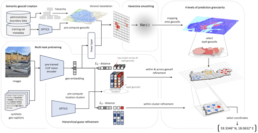
Super fun geoguesser learning model; paper at the link. I’m a little annoyed they are keeping the trained model secret, I wonder if this is something that OSM would find useful.
Street View, satellite photography, aerial photography, lidar, corner detection, we have have had all the legos to map every building geometry for decades; I’m sure there are more impressive datasets and tools out there. Nice to see open research that didn’t get classified.
You must log in or register to comment.

